Auditing Disability Access
Many of our streets and town centres in Aotearoa New Zealand aren't accessible for disabled people. This can be because of narrow footpaths, a lack of kerb cuts, nowhere to sit and rest when you get tired, or a lack of disability parking, among other issues. How do we know where these issues are and add them to the pipeline of works for repairs or upgrades?
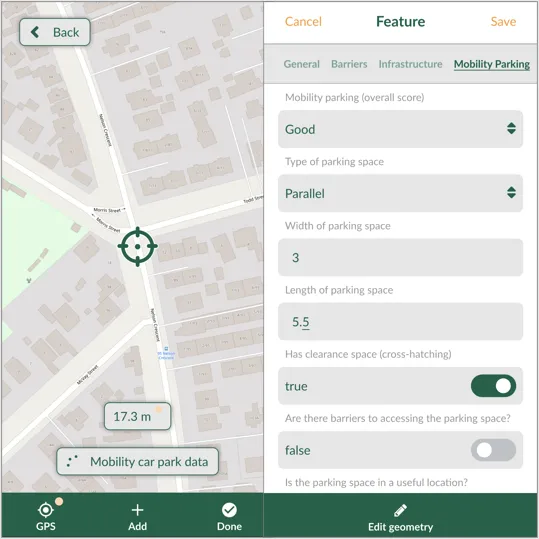
At MRCagney, we've developed a process to make user-friendly data collection apps quickly and easily. The apps are integrated with QGIS for easy analysis and styling post-data collection. We typically use Mergin Maps as our app of choice, but QField has also proven to be a really good app. The following image shows the map view on the left and the form view on the right of the Mergin Maps app.

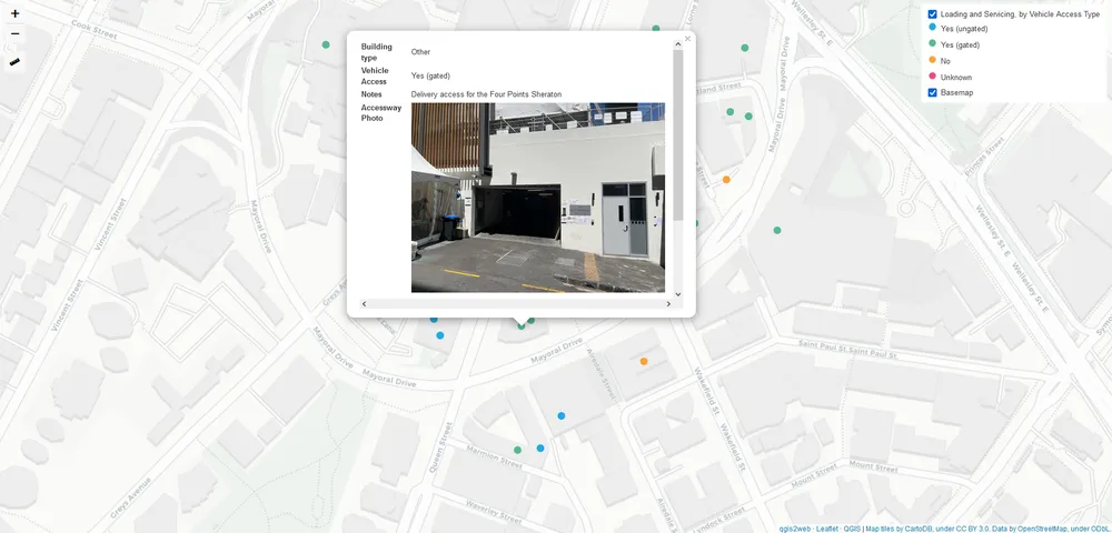
Once we're happy with the layout and survey design of the app, we send our auditors out to collect some data. And when they return, we have a semi-automated process to produce a Microsoft Word report with an index of their collect data, as well as some interactive, online maps which we can put online in a password-protected web application, like the screenshot below.

The app can be generalised for collecting any kind of spatial data, like surveying disability parking or loading and servicing spaces in a city centre.
"This new tool made the data collection and processing task so much quicker and easier. It was great to be able to visualise the data we collected on a map with photos for each location point. I will definitely be using this again" ~Scott Ebbett, Principal Consultant at MRCagney
"I love the reliability of seeing where the data was collected, and what was recorded. It's a great way to share data with our clients too, because an interactive map is instantly easier to digest than a lengthy appendix" ~Bridget Doran, Principal Researcher at MRCagney
 MRCagney Works