Connected Communities
In 2019, Auckland Transport (AT) commissioned us to analyse public transport flows across thirteen key corridors in central Auckland as part of the Connected Communities project. Connected Communities aimed to improve the place-making, walking, cycling, and public transport along these corridors and, to that end, the project team needed to find the problem spots.
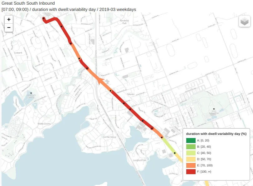
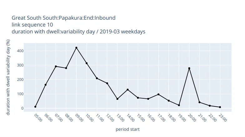
To help them with the public transport aspect, we combined scheduling, realtime, and ticketing data to compute travel time, passenger flow, and reliability statistics across the corridors. This involved collaborating with AT to develop custom measures and classifications for public transport reliability. We then mapped and charted this data to create a comprehensive, interactive, and simple-to-use set of inputs for use by transport planners and design experts.
Creating outputs for these thirteen corridors, during multiple time periods on both weekdays and weekends, restuled in hundreds of unique maps and charts. To improve usability, we collated these outputs into a single website to share with the Connected Communities design experts, who then used the visualisations to quickly spot bottlenecks and troublesome segments for more in depth analysis and eventual redesign.
While an interactive web application similar to our Affordability Map would have been a tidy solution here, AT's budget and time was quite constrained, so we opted for a static collection of visualisations to meet their needs.