GTFS Explorer
Our Public Transport Team was struggling to extract data from the rich but complex file format known as General Transit Feed Specification (GTFS), in which most public transport agencies publish their scheduling data. They knew GTFS was a treasure trove of information for their projects, but they could not unlock it with their standard tools of spreadsheets and geographic information software.
To help them, we created a key, GTFS Explorer, a web application to analyse and visualise GTFS data from any source.
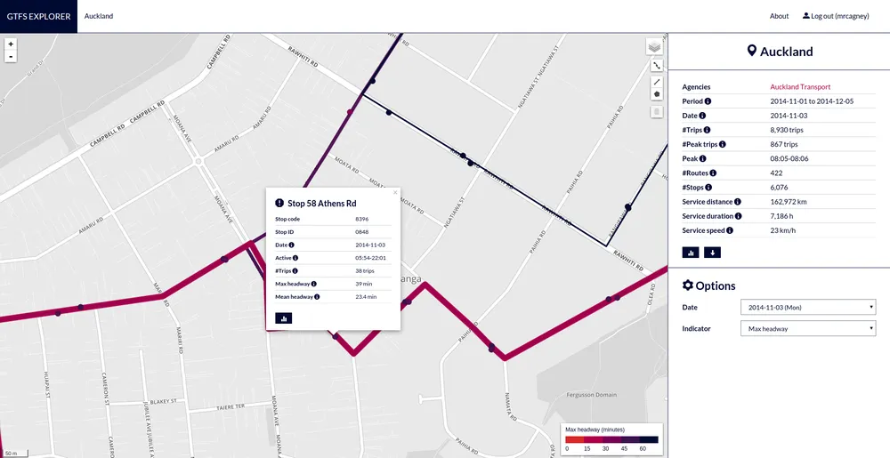
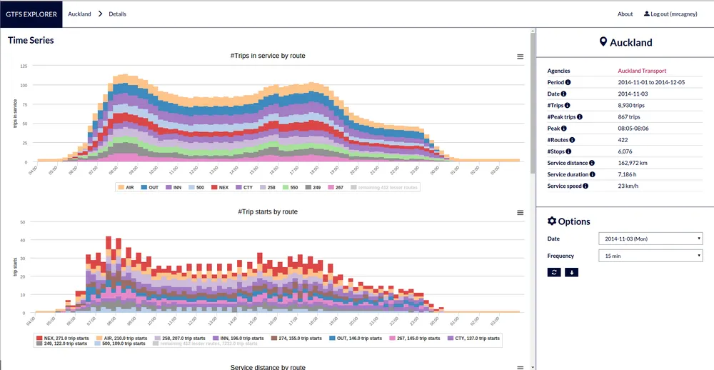
GTFS Explorer computes and shows a suite of useful public transport network indicators, such as service distance, service speed, and peak vehicle requirements.
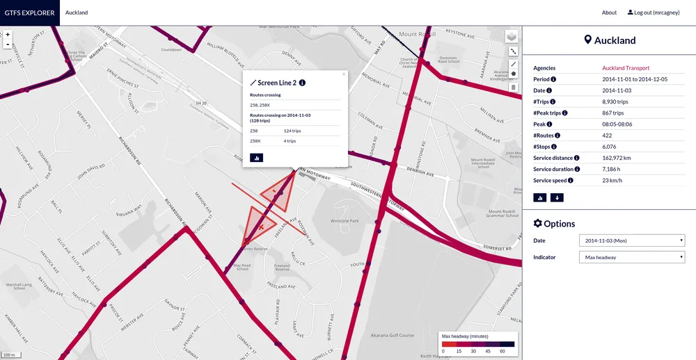
It can also compute scheduled vehicle counts across screen lines drawn by the user.
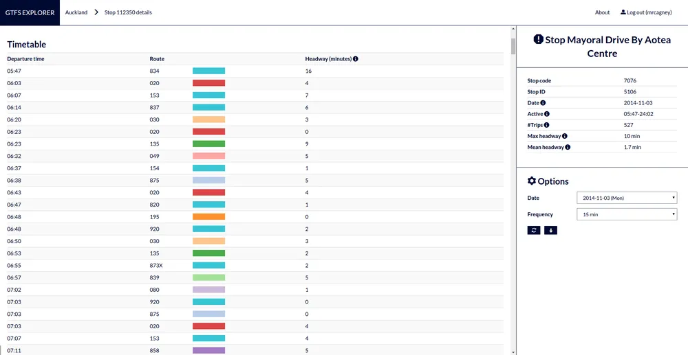
And compute timetables for stops and routes, all with a few clicks of the mouse.
GTSF Explorer eases the quantitative side of our Public Transport Team's job. Gone now, for example, are the days of tediously combing through timetables and spreadsheets to calculate service hours and screen line counts.