MRCagney Maps: Whangārei
In mid 2023 Whangārei District Council hired us to help them create a future development strategy (FDS), which sets the high-level vision for accommodating urban growth in their district over the long term. As the project progressed, the geospatial component became increasingly critical. Council needed to decide where growth should happen while considering constraints on development, such as zoning rules, flood areas, and productive soils. To that end, the project team wanted an online interactive map showing all the geographic layers relevant to the project that we could all refer to while crafting the FDS.
Geospatial readers, how would you meet that brief?
A typical approach would be to collect the layers, clean them up, and load them into ArcGIS Online. Nothing wrong with that, but our data science team wanted to use our standard and favourite open-source tooling: Python, Jupyter, GeoPandas, and Dash apps deployed to our own server. So we did, and here's what we made.
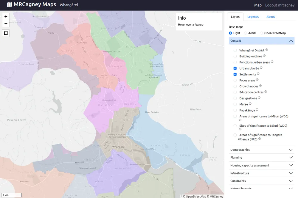
It's an online interactive map with all the essentials: login, navigation bar, a tiled web map, controls, various base maps, all the relevant layers toggleable, legends, hover info, and a measure tool.
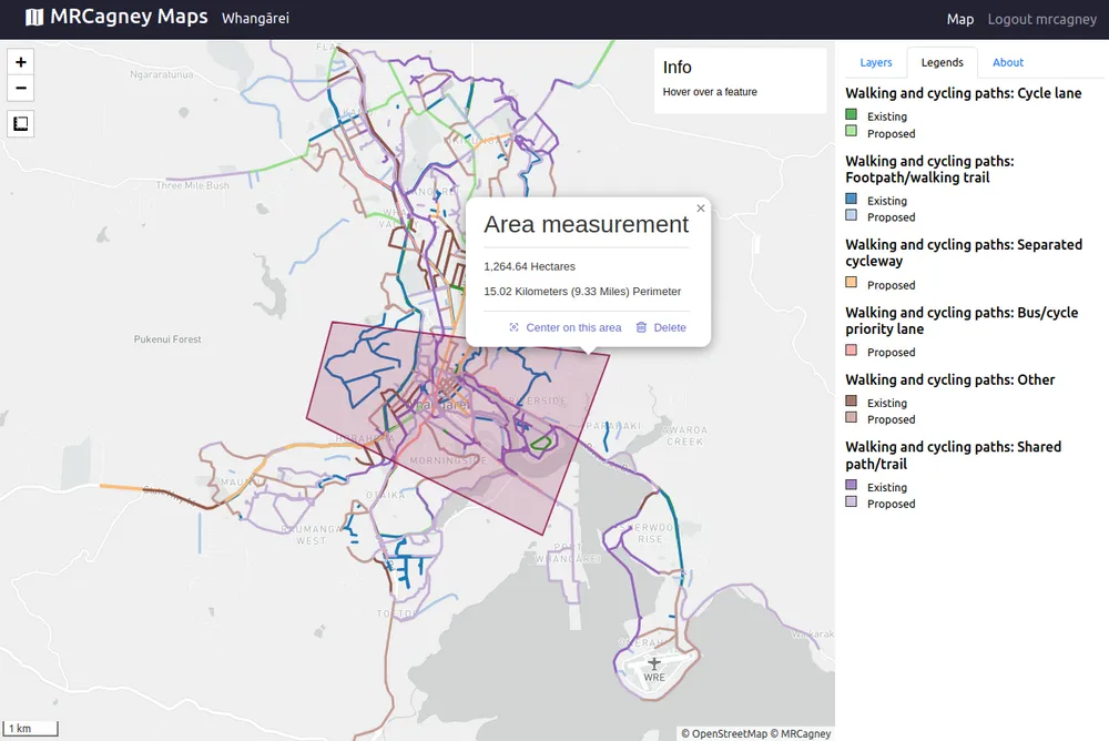
Big thanks to the Dash Leaflet library for handling most of the application's user interface! We used it for the first time on this project and found it powerful and easy-to-learn.
And how did it all go?
"[MRCagney Maps: Whangārei] helped our project team and client visualise the context and complex, interconnected layers of what makes up the district and what would impact its future development. This tool made data accessible and easy to apply when we were developing, testing and refining the future-focused scenarios for Whangārei District." ~Meredith Dale, Senior Urban Designer & Strategist at The Urban Advisory