Welcome to the portfolio of MRCagney's Data Science Team, a curated collection of past projects to showcase our capabilities and inspire future work.
We distill data into insights for decision makers.
Email us if you'd like our help.
Sort by
Newest first
Oldest first
Title (A–Z)
Filter by tag
No filter
Accessibility
Economics
Emissions
Housing
Other
Public Transport
Walking & Cycling
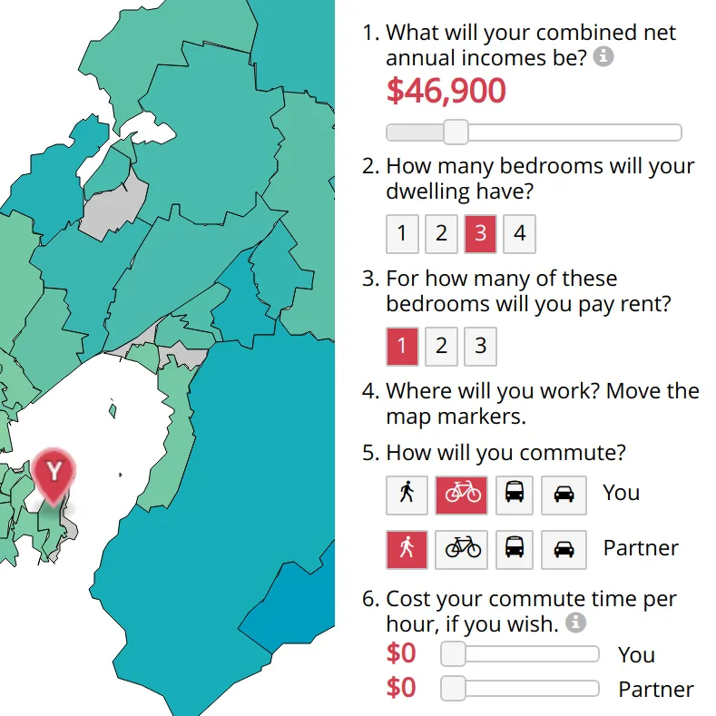
Affordability in New Zealand
A visualisation of housing affordability in various regions of New Zealand
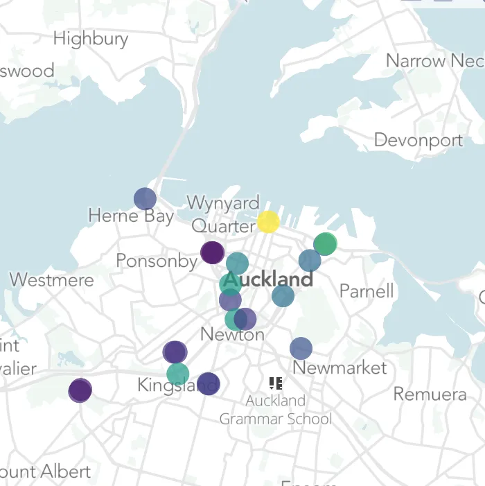
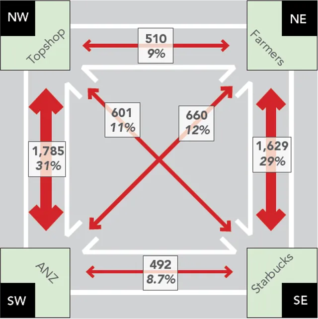
AT Transit Flows
A visualisation of vehicle flows through Auckland's current and future transit networks
Auckland Transport Model Kit
A software package to compute economic benefits from Auckland's transport model outputs
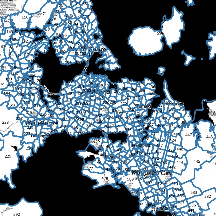
Auckland Walking and Cycling Counts
A visualisation of Auckland's walking and cycling counter data
B Corper
A visualisation of all certified B Corporations in the world
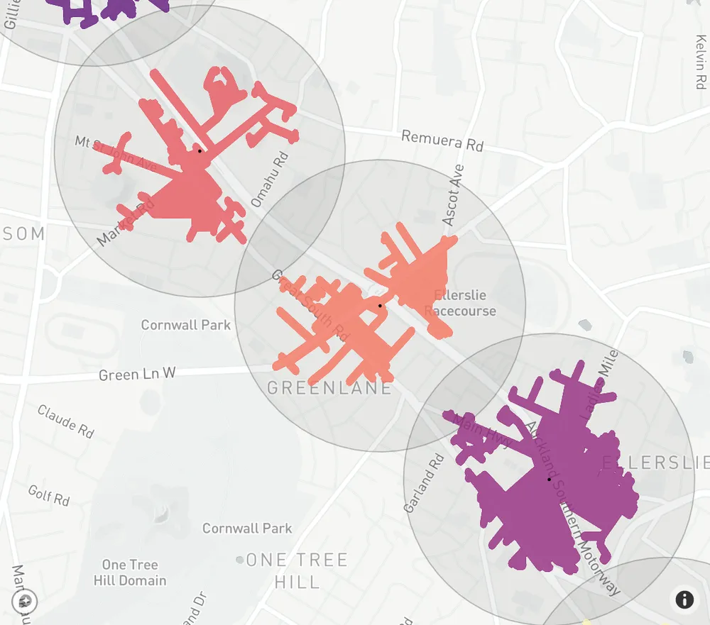
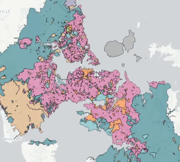
Catchies
A visualisation of walking catchments around busway, train, and ferry stations in Auckland
Census Sampler
Estimating New Zealand Census totals for custom geographies or isochrones thereof
Connected Communities
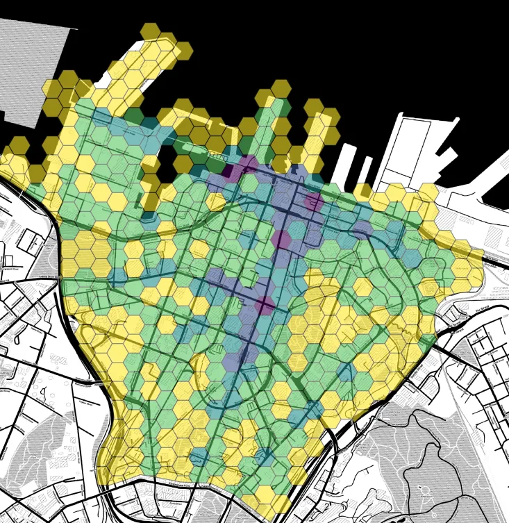
Analysing and visualising central Auckland's public transport corridors
Corridor Explorer
A web application to analyse and visualise key corridors in South East Queensland's public transport network
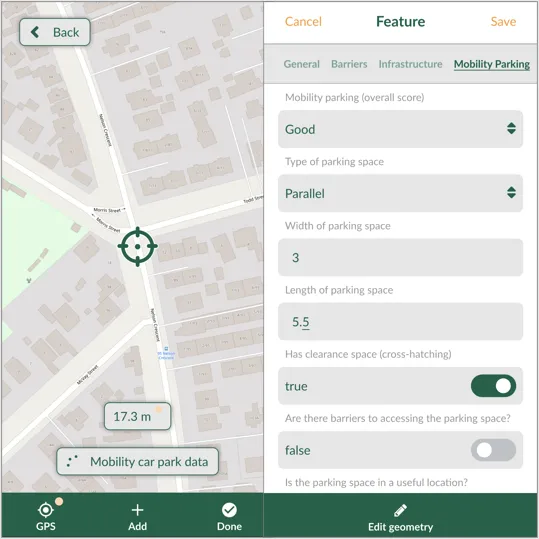
Auditing Disability Access
A phone app for collecting spatial data to audit the disability access of streets and town centres
E-Scooter Analysis
A toolkit to analyse and visualise rental e-scooter trips in Auckland
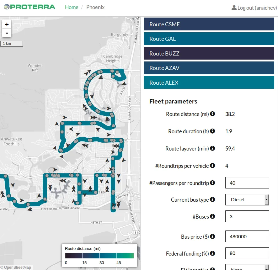
EV Simulator
A web application for Proterra, the electric bus manufacturer
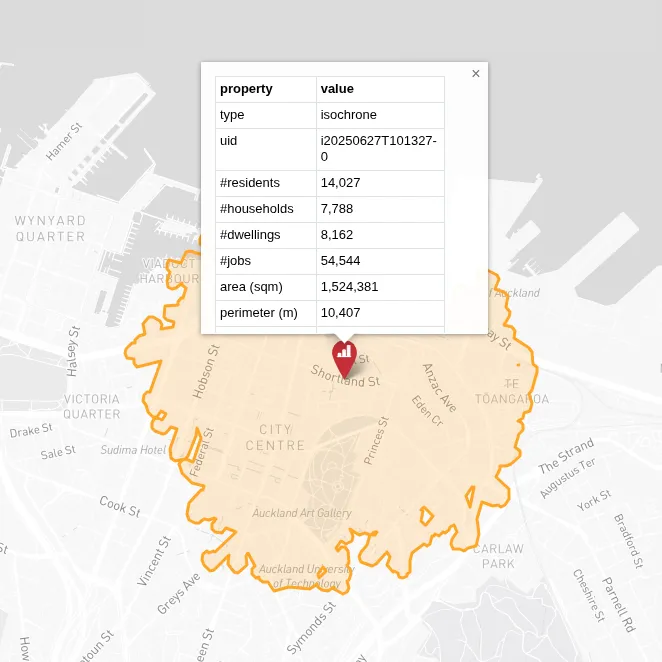
Gradient Isochrones
Visualising the variation in public transport isochrones
GTFS Explorer
A web application analysing and visualising public transport networks
GTFS Kit
An open-source software package for analysing General Transit Feed Specification (GTFS) data
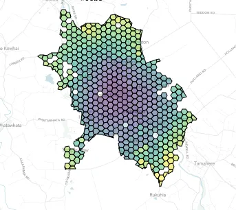
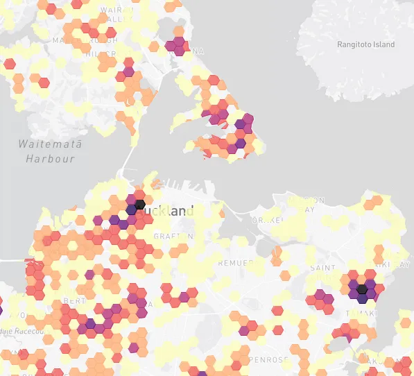
Job Accessibility
A data story of access to jobs in Hamilton, New Zealand
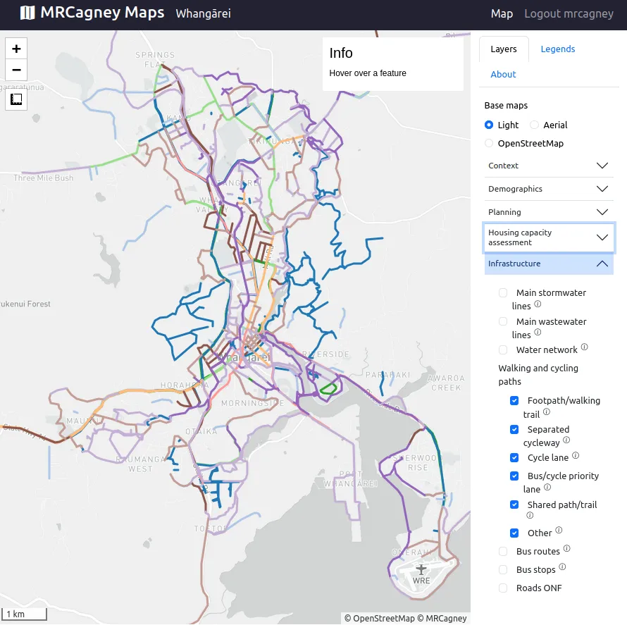
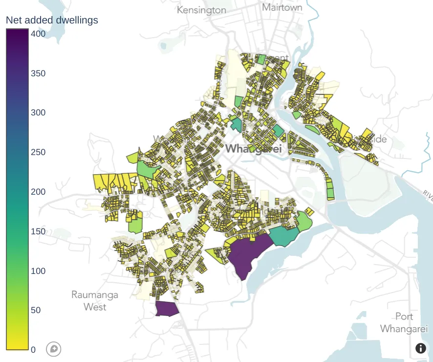
MRCagney Maps: Whangārei
A online map viewer for Whangārei's Future Development Strategy
MRCagney Reports
Interactive reports on MRCagney's projects, staff, and company
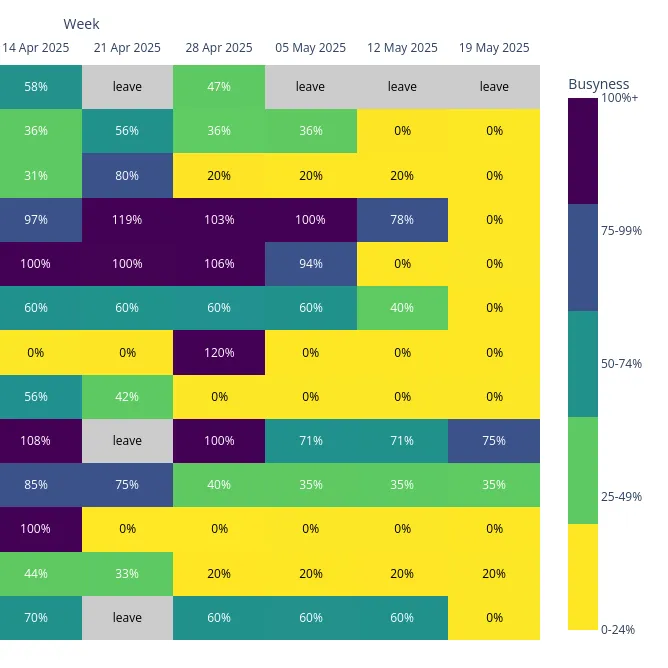
MRCagney Resourcing
Up-to-date forecasts of our staff utilisation and busyness
New Zealand Land Value Model
A software package to model New Zealand land value differences across planning zone boundaries
Playground Accessibility
A data story of access to playgrounds in Auckland, New Zealand
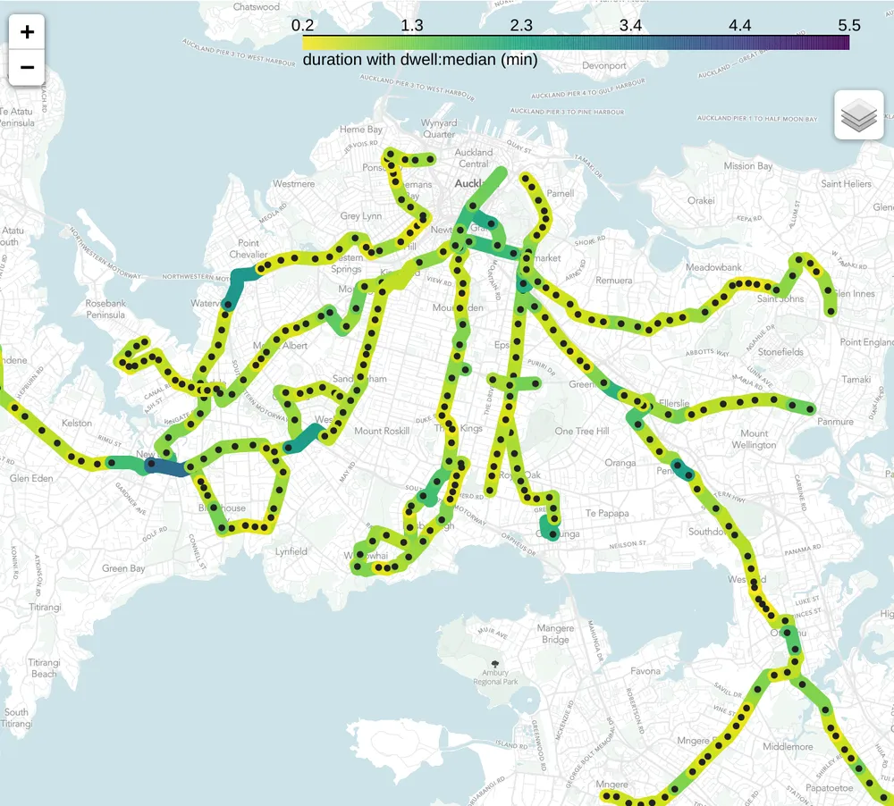
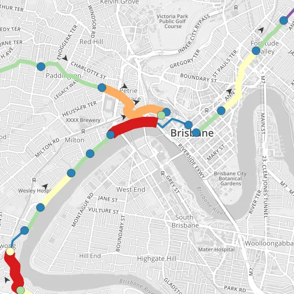
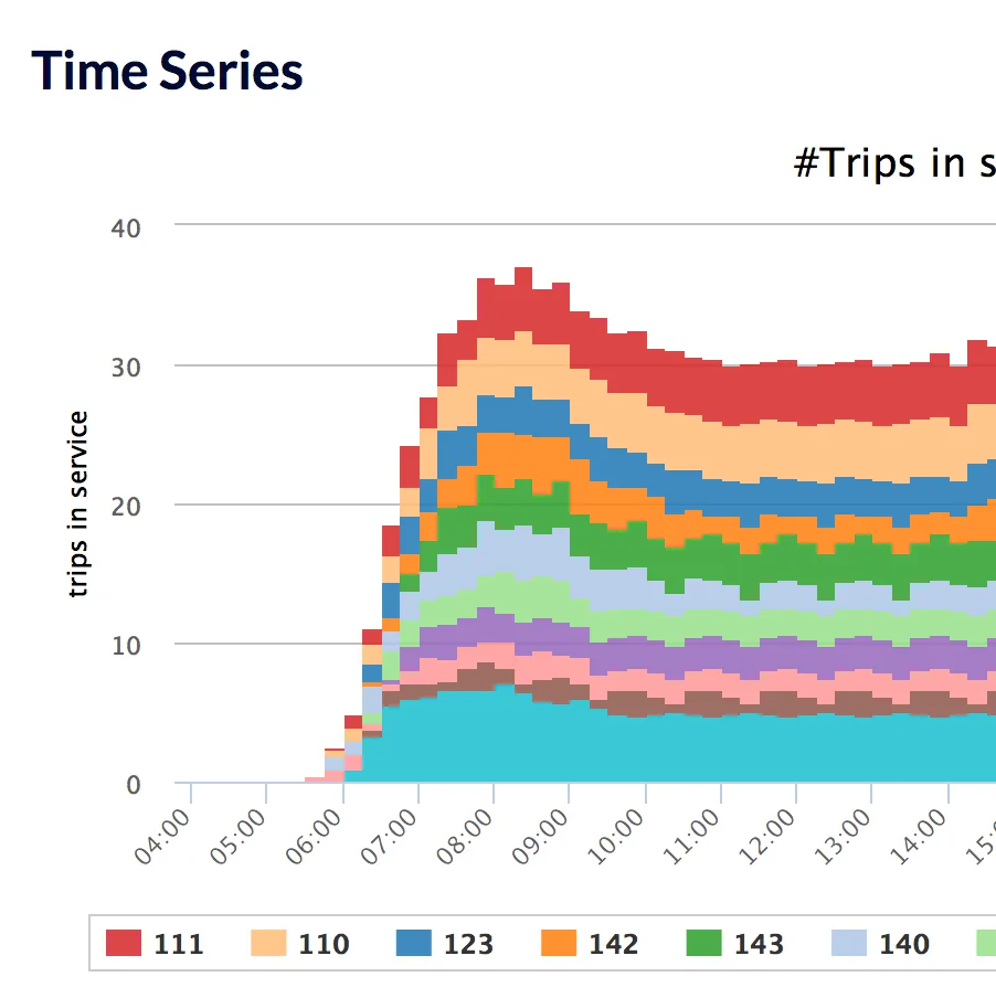
Transit Flows
A visualisation of public transport vehicle and passenger flows
Transit Stops
A visualisation of public transport passenger boardings and alightings
Transport 2030
How changing Auckland's transport network can reduce its carbon emissions
Transport 2035
Estimating future CO2-e emissions for land transport in New Zealand
Valuing Pedestrians
A process for estimating the value of delays to pedestrians at busy, city centre intersections.
Wavetrace
An open-source software package to model radio signal propagation
Whangārei Housing and Business Assessment
Analysing housing and business capacity in Whangārei